 SJVAir Toolkit
Static Maps
map create
Render a single static map image, live or as of a historical timestamp. Requires pip install sjvair[maps] (matplotlib, contextily, geopandas, shapely).
Pick an area with --region (repeatable — ID or name) and/or --bbox "west,south,east,north". Or use a shortcut instead of --region — --county, --city, --zip, --tract (FIPS), --urban (urban-area name) — each resolved by type, so --urban Fresno can’t accidentally match the county or city of the same name. Only one shortcut at a time. --scope region (default) queries only monitors covered by the region polygon(s); --scope viewport queries everything visible in the viewport instead. --buffer pads the viewport around --region without changing what gets queried (unless --scope viewport).
# Live snapshot of Fresno County right now
sjvair map create \
  --type pm25 \
  --county Fresno \
  --output fresno-now.png
# Live snapshot of Fresno County right now
sjvair map create `
  --type pm25 `
  --county Fresno `
  --output fresno-now.png
# Same, but as of a specific moment last July 4th (see Usage > Timestamps
# for --tz -- without it, a naive timestamp like this is UTC, not local time)
sjvair --tz America/Los_Angeles map create \
  --type pm25 \
  --county Fresno \
  --timestamp "2026-07-04 20:30:00" \
  --output fresno-2026-07-04.png
# Same, but as of a specific moment last July 4th (see Usage > Timestamps
# for --tz -- without it, a naive timestamp like this is UTC, not local time)
sjvair --tz America/Los_Angeles map create `
  --type pm25 `
  --county Fresno `
  --timestamp "2026-07-04 20:30:00" `
  --output fresno-2026-07-04.png
# Manual bounding box, everything in view (not just inside a region)
sjvair map create \
  --type pm25 \
  --bbox "-120.2,36.4,-119.5,37.0" \
  --scope viewport \
  --output custom-area.png
# Manual bounding box, everything in view (not just inside a region)
sjvair map create `
  --type pm25 `
  --bbox "-120.2,36.4,-119.5,37.0" `
  --scope viewport `
  --output custom-area.png
# Pull in monitors just outside the county line too
sjvair map create \
  --type pm25 \
  --county Fresno \
  --buffer 0.1 \
  --scope viewport \
  --output fresno-wide.png
# Pull in monitors just outside the county line too
sjvair map create `
  --type pm25 `
  --county Fresno `
  --buffer 0.1 `
  --scope viewport `
  --output fresno-wide.png
Other options: --location {inside,outside} (omit for both — filtered client-side, since the API has no location filter of its own), --legend/--no-legend, --timestamp-label/--no-timestamp-label (both default on), --width/--height (pixels, default 1600×1200), --marker-size (monitor marker size, default 220).
Example
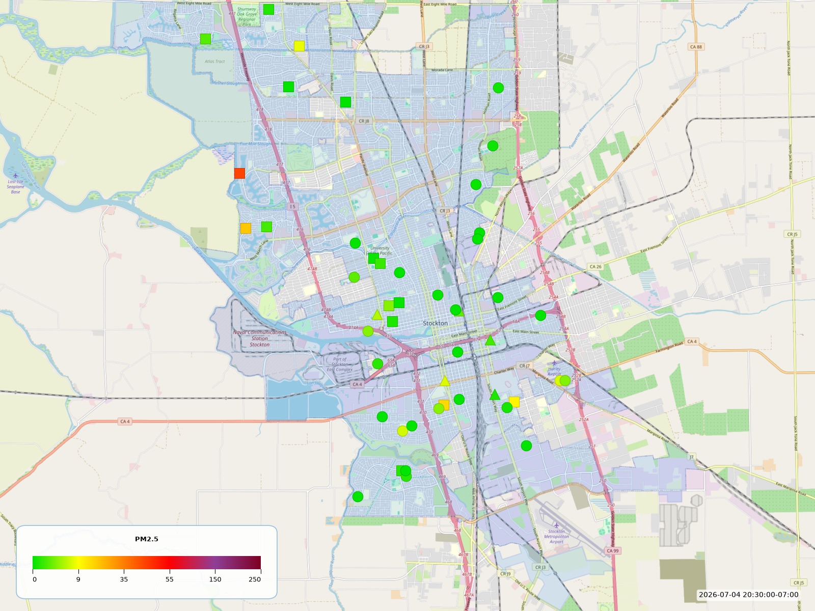
Stockton, 8:30pm on July 4th, 2026, outdoor monitors only:
sjvair --tz America/Los_Angeles map create \
  --type pm25 \
  --region kzbet \
  --timestamp "2026-07-04 20:30:00" \
  --location outside \
  --output stockton-2026-07-04.png
sjvair --tz America/Los_Angeles map create `
  --type pm25 `
  --region kzbet `
  --timestamp "2026-07-04 20:30:00" `
  --location outside `
  --output stockton-2026-07-04.png